Warning: Undefined array key "ssba_bar_buttons" in /home/ybv4ow29f690/public_html/hawaiipictureoftheday/wp-content/plugins/simple-share-buttons-adder/php/class-buttons.php on line 598
Warning: Undefined array key "ssba_bar_buttons" in /home/ybv4ow29f690/public_html/hawaiipictureoftheday/wp-content/plugins/simple-share-buttons-adder/php/class-buttons.php on line 598
Warning: Undefined array key "ssba_bar_buttons" in /home/ybv4ow29f690/public_html/hawaiipictureoftheday/wp-content/plugins/simple-share-buttons-adder/php/class-buttons.php on line 598
Warning: Undefined array key "ssba_bar_buttons" in /home/ybv4ow29f690/public_html/hawaiipictureoftheday/wp-content/plugins/simple-share-buttons-adder/php/class-buttons.php on line 598
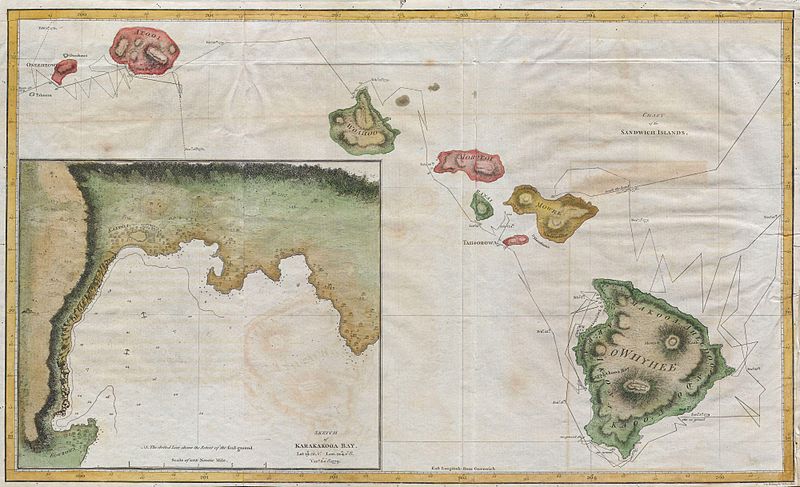
This stunningly well-drawn map, reportedly created in 1785 by Captain Cook and his officer Bligh, fairly accurately depicts the Hawaii island chain.
Imagine creating a chart such as this without the aid of modern-day GPS, airplane photography, satellites, or cameras.
And yet, Cook and his men were able to do so to a highly-detailed degree. Amazing.


