警告: 未定義の配列キー "ssba_bar_buttons" で /home/ybv4ow29f690/public_html/hawaiipictureoftheday/wp-content/plugins/simple-share-buttons-adder/php/class-buttons.php オンラインで 598
警告: 未定義の配列キー "ssba_bar_buttons" で /home/ybv4ow29f690/public_html/hawaiipictureoftheday/wp-content/plugins/simple-share-buttons-adder/php/class-buttons.php オンラインで 598
警告: 未定義の配列キー "ssba_bar_buttons" で /home/ybv4ow29f690/public_html/hawaiipictureoftheday/wp-content/plugins/simple-share-buttons-adder/php/class-buttons.php オンラインで 598
警告: 未定義の配列キー "ssba_bar_buttons" で /home/ybv4ow29f690/public_html/hawaiipictureoftheday/wp-content/plugins/simple-share-buttons-adder/php/class-buttons.php オンラインで 598
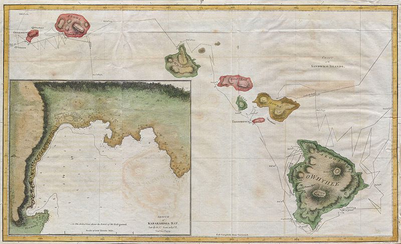
この驚くほどよく手描きマップ, 伝えで作成された 1785 キャプテンクックと彼の役員ブライによって, かなり正確にハワイ島のチェーンを示しています.
現代のGPSの助けを借りずにこのようなチャートを作成して想像する, 飛行機写真撮影, 衛星, またはカメラ.
とまだ, クックと彼の部下は、高精細度に行うことができました. 驚くべき.


