Warning: Undefined array key "ssba_bar_buttons" in /home/ybv4ow29f690/public_html/hawaiipictureoftheday/wp-content/plugins/simple-share-buttons-adder/php/class-buttons.php on line 598
Warning: Undefined array key "ssba_bar_buttons" in /home/ybv4ow29f690/public_html/hawaiipictureoftheday/wp-content/plugins/simple-share-buttons-adder/php/class-buttons.php on line 598
Warning: Undefined array key "ssba_bar_buttons" in /home/ybv4ow29f690/public_html/hawaiipictureoftheday/wp-content/plugins/simple-share-buttons-adder/php/class-buttons.php on line 598
Warning: Undefined array key "ssba_bar_buttons" in /home/ybv4ow29f690/public_html/hawaiipictureoftheday/wp-content/plugins/simple-share-buttons-adder/php/class-buttons.php on line 598
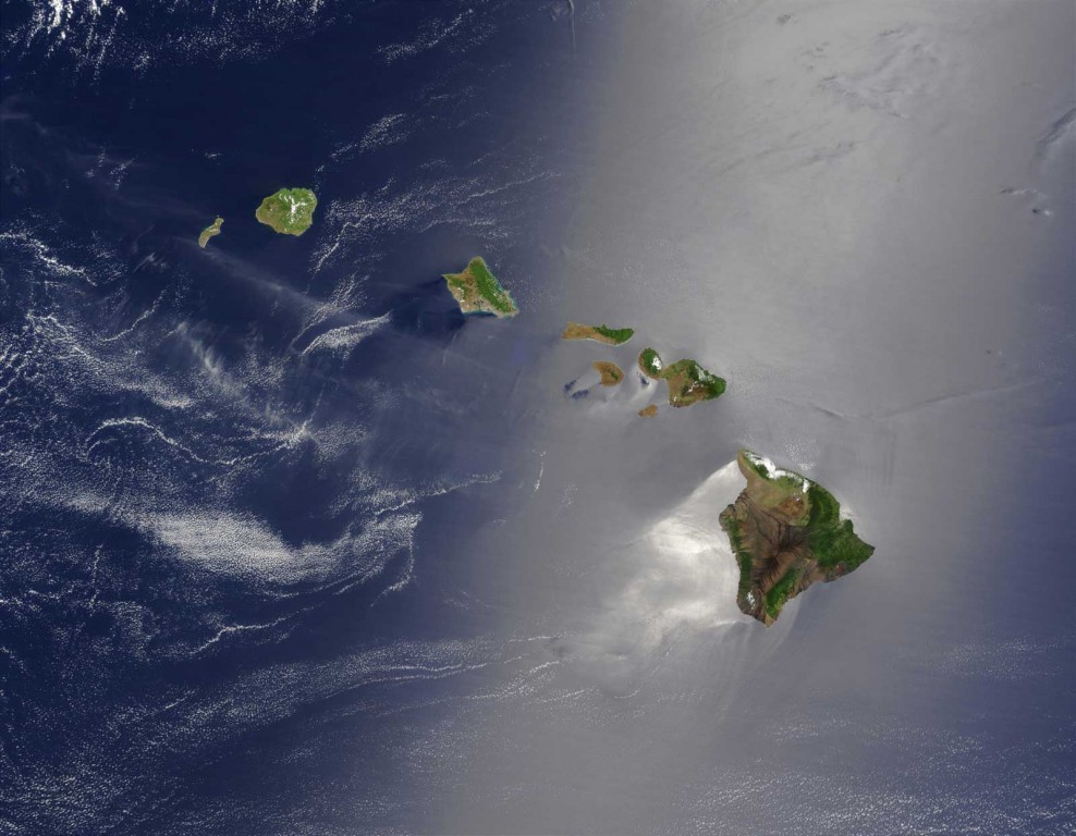
Ever wondered just what Hawaii looks like from outer space? It looks awesome.
This picture, courtesy Jacques Descloitres, MODIS Land Rapid Response Team at NASA GSFC, shows a true color image of the state of Hawaii from an orbiting satellite. Showing all seven major islands in the Hawaiian island chain, the picture covers from the Big Island through the, “Forbidden Island” of Ni’ihau.
Looking really closely at the lower right edge of the Big Island, one can make out what appears to be a red dot. This dot is actually a hot spot within Kilauea volcano visible from space.
The description below explains the blue grey line cutting through the middle of the photo.
“A silver swath of sunglint surrounds half of the Hawaiian islands in this true-color Terra MODIS image acquired on May 27, 2003. Sunglint reveals turbulence in the surface waters of the Pacific Ocean. If the surface of the water was as smooth as a perfect mirror, we would see the circle of the Sun as a perfect reflection. But because the surface of the water is ruffled with waves, each wave acts like a mirror and the Sun’s reflection gets softened into a broader silver swath, called the sunglint region.” – NASA Earth Observatory


